Click the thumbnail to see the storm come to life.
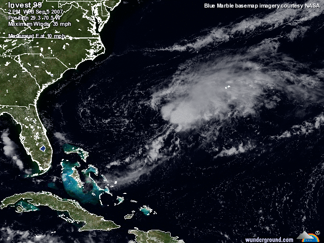
Well it looks like we may be in for an actual hurricane in the Carolina’s. Disturbance 99L is shaping up quite nicely. The GFDL model shows a little circulation and tropical storm development for tomorrow. Once the high pressure moves off the North Carolina coast, this makes room for the disturbance to develop and become organized and head on a more westerly direction. The high has kept the storm from moving towards the east coast.Some of the models show the storm “fishing” which means turning away from the coast and heading out to sea. This one bears watching because all of the models have it developing at about 96 hours out. The GFDL has it becoming a Cat 2 and nailing the Carolina’s. As usual, we just have to wait and see if we have Gabrielle coming to visit. I may be paddling out to my special place well off the coast sometime this weekend. The seas will be on the rise through the weekend. It’s going to be messy unless you know where to go for cover to avoid the strong NE winds. And there is more than one place in Southern NC. Regardless of the surf, we should keep our eyes on it just in case we have to make any last minute preparations. I’ll update tomorrow after one of the later model runs unless anything significant happens overnight.
There is another system that should be falling off Africa in the next few days and it appears that a tropical depression will form off the Cape Verde Islands. So far the models show this one going along the same path as Dean. It’s way out and the models don’t do so well when systems are this far out. It’s good to watch them though. The African Wave Train is alive and well right now and September could blow up.


Recent Comments